
Islands in the Crouch & Blackwater
North Sea
Although there are many sandbanks that are uncovered at low tide there are no natural islands in the sea although there are a number of manmade structures including wind farms, Maritime warning beacons and wartime defence towers.
River Crouch
Bridgemarsh Island

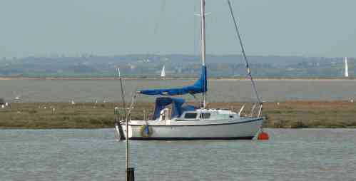
Bridgemarsh Island with River in background
Bridgemarsh Island is about 3 miles
upriver from Burnham on Crouch within the Parish of
Althorne.
Good views of the island can be taken
from the main South Woodham Ferrers to Burnham road. This
view shows that today the island is mainly marshland which
is frequently overrun by high tides. The tower blocks of
Southend on Sea can be seen on the opposite River bank.
The island has a long history of
cultivation by man. Records exist of a bad flood in 1736
following which it was drained, piled and enclosed by a sea
wall.
Following the protection the island was
used for cattle and sheep with additional uses from hunting
the abundant wild duck and catching eels which proliferated
in the internal dykes.
A causeway was constructed from
Stamford Farm which allowed access to the island at low
tide. The causeway was never entirely dry although it was
easily fordable.
During a bad flood in 1897 the sea wall
was breached and some livestock was drowned. Although some
repairs were carried out part of the island was lost to the
river for ever.
Farming was supplemented by industry
with the island used for clay extraction and then the
development of a brick and tile works fed by a tramway
linking the works to the quay on the Riverside which was
serviced by Thames Barges. Fredrick Bradbrook and James
Bates worked the site in 1870 and then The Bridgemarsh
Brickfields Co. Limited worked the site from 1878 to 1882.
Problems with the location and the need to use a wash pan to
separate the clay from stones proved that this location was
not viable and in 1892 the brickworks were abandoned.
Despite the warning no serious effort
was made to maintain the seawalls which suffered further
damage by floods in 1928.
The great floods of 1953 provided the final nail for Bridgemarsh Island. The whole of the east coast suffered serious flooding. The clay base at Bridgemarsh was used by servicemen to fill sandbags that were used to protect other areas of the coastline. Ironically Bridgemarsh itself was not protected from the flood and surrendered to the sea.
Remnants of the old farmhouse and some seawalls can still be seen at low tide. The island is now a haven for wildlife and salt marsh flowers that can flourish without the attention from man for the first time for hundreds of years.
Foulness Island, Potton
Island, Rushley Island, Havengore Island, New England Island
The islands are home to a large MOD
firing range although there are some inhabitants faming the
land. The islands are home to a large MOD
firing range although there are some inhabitants faming the
land.
The islands are outside the
geographical area covered by this web site and as such are
not detailed.
River Blackwater
Pewit Island
Pewit Island is sited in the mouth of
Bradwell Creek..
The island is unprotected marshland which provides protection to craft entering and leaving Bradwell Marina.
Pewit Island has never been inhabited or used for farming purposes and remains a haven for sea birds.
Ramsey Island
Ramsey Island is about 2 miles upriver
from Pewit Island.
Thanks to the sea defence works Ramsey
Island is no longer a real island having been reclaimed to
the extent that it merges with nearby St Lawrence Village.
It is only at times of flood that it returns to its island
status. Thanks to the sea defence works Ramsey
Island is no longer a real island having been reclaimed to
the extent that it merges with nearby St Lawrence Village.
It is only at times of flood that it returns to its island
status.
The area is punctuated with dykes and
other evidence of the reclamations that has been ongoing
since the 10th century.
Ramsey Island is rich in history having
been frequented by the Romans who used the area for salt
production as evidences by the presence of a 'red hill'
which is an indicator of the production.
Both of the islands are sited in the
Blackwater and both have interesting histories.
The island are just outside the
geographical area covered by this web site and as such are
not detailed.
Further Information
Local Author Ian Yearsley has written an excellent book called Islands of Essex which provides much more details on our islands.